When I was asked to write about “13 best hikes in Southern California,” I had a problem – how do I choose just 13? With an abundance of routes, an extensive range of diverse landscapes, and hikes that can take from an hour to a day, So Cal is a hiker’s paradise.
My editor warned me to stick to the “best 13 hikes” plan, but they didn’t distinguish between The 13 Best Hikes In Southern California and 13 Of The Best Hikes In California. So here are 13 of the best hikes in Southern California, and feel free to submit your nominations in the comments.
Lower Malibu Creek Loop, Malibu Creek State Park
Distance: 8 miles
Average Time: 4 hours
Lower Malibu Creek Loop takes you on a gentle, meandering trip through grassland trails, wetland like ecosystems, and pretty, shaded creek-side paths. There’s also a fabulous rock pool, a range of fishing spots, and several side hikes if you want to extend your day.
Roughly a quarter of the way along, you can stop at a picnic bench that’s been set up at the spot where M*A*S*H was filmed. If the rusted vintage vehicles aren’t what you want to see, in the opposite direction, there’s the Goat Buttes outcrop to take in.
Know before you go:
- The park opens at 8 am, but if the rangers are there early, they’ll let you in.
- Migratory birds fill the park during spring.
- The spot by the first bridge is often used for baptisms at the weekend.
Woodson MountainTrail, Poway
Distance: 6.4 miles
Average Time: 3 to 4 hours
The route from Lake Poway will take you through granite boulders, chaparral, and to the base of a lone dead oak tree where you can rest and take in the magnificent views. On a clear day, you even pick out downtown San Diego on the horizon.
At the top of Mount Woodson, you’ll find not only spectacular views but the famous Potato Chip Rock upon which you can pose for photos – if you dare.
Know before you go:
- You won’t find any shade on this hike, so be prepared with plenty of water, sunscreen, and a hat.
- The trail is challenging and for experienced hikers only.
- Start out at 6 am to avoid the crowds.
Salt Creek Interpretive Trail, Death Valley National Park
Distance: 1-mile loop
Average Time: 30 minutes.
A gentle walk rather than a hike, the Salt Creek Interpretive Trail is a wheelchair-accessible boardwalk path through the salt marsh at 150 feet below sea level.
The water only flows down as far as the boardwalk from around November to May, and the best time to visit is between February and April when the Salt Creek Pupfish are spawning.
Know before you go:
- Don’t visit between June and October; it’s dangerously hot.
- Interpretive signs along the trail describe the flora and fauna.
- It’s a delicate ecosystem, so no dogs are allowed.
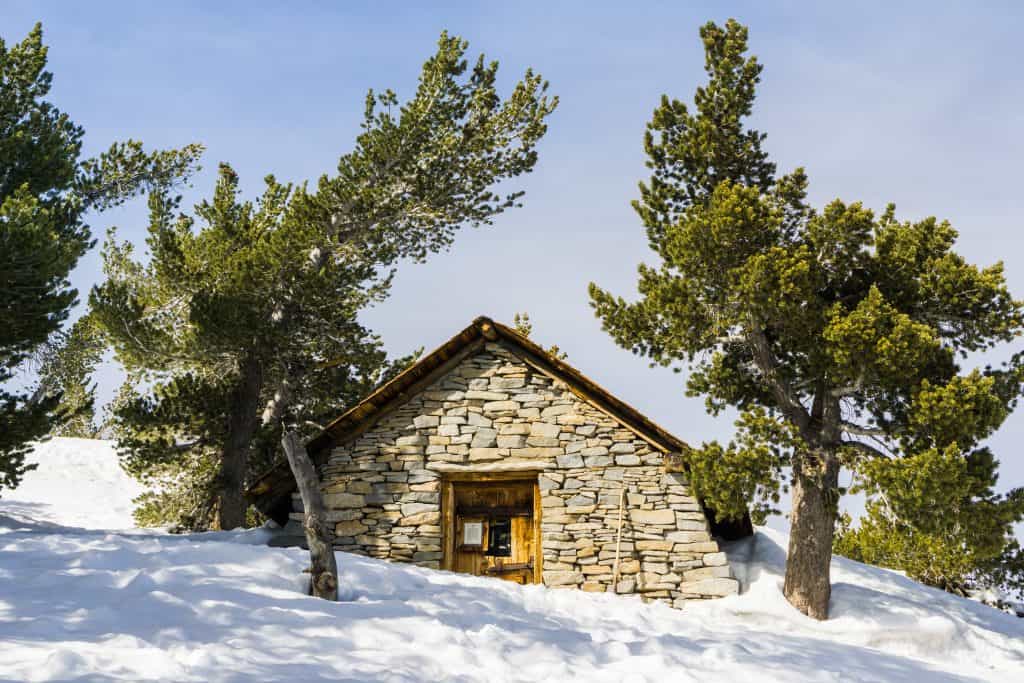
San Jacinto Peak, Mount San Jacinto State Park
Distance: 10.5 miles
Average Time: 9 hours
There are several long, challenging hikes to San Jacinto Peak, but the most popular route is where you take the aerial tramway to the trailhead. The floor of the tram goes through 2 complete rotations during the climb, allowing you a view in all directions.
Between November and March, you are likely to encounter snow and ice, so microspikes at a minimum are a must. During the summer you’ll need at least 3 liters of water as there are no facilities and little shade.
Know before you go:
- Book ahead for a spot on the tram, or you may have to wait for a free seat.
- Check-in at the rangers station before you begin your hike is mandatory.
- Snow and ice are likely at the summit so prepare accordingly.
Smuggler’s Cove Trail, Channel Islands National Park
Distance: 8 miles
Average Time: 4 to 5 hours
Take a trip out to Santa Cruz Island for a spectacular hike to Smugglers Cove. Once you disembark from the boat, you’ll see a windmill, and this is where the trail begins. You’ll take in magnificent views and on a clear day, you can right across to the mainland.
Unless you’re a fast, experienced hiker, you won’t manage the boat trip and entire hike in one day. If that’s the case, take the oil well trail, which is shorter and allows you to explore the abandoned but preserved oil well.
Know before you go:
- There are pit toilets at the beach.
- The downhill stretch to the cove has lots of loose rocks.
- Excellent spot for beachcombing.
Solstice Canyon Trail, Santa Monica Mountains National Recreation Area
Distance: 2.6-miles round trip
Average Time: 1 ½ hours
This mostly level trail takes you on a trip of discovery through the intermittent shade of oaks, alders, and sycamores with a generous sprinkle of colorful flowers in the spring. You’ll see the ruins of The Keller House, an old hunting cabin destroyed by fire, and, if you’re lucky, there’s birds and wildlife to discover.
At the far end of the trail, you’ll find Tropical Terrace, the ruins of the Roberts Ranch House. Partially destroyed by wildfires in 1982, you can explore the ruins and learn more of the home’s history from the site’s information panels.
Know before you go:
- Carefully climb the steep trail by the waterfall and discover some beautiful pools.
- Walk clockwise for the best ocean views.
- No cell phone reception.
Yucca Point Trail, Torrey Pines State Reserve
Distance: 4-mile round trip
Average Time: 2 hours
Yucca Point Trail is a gentle, well-marked hike that features a beautiful beach at it’s furthest point, and If you have extra time you can while away several hours exploring the ocean’s edge.
Not that there’s a lack of interest on the rest of the hike, on the contrary, the stunning rock formations and fragile eco-systems you’ll discover are so delicate that there are steep fines if you wonder from the marked trails.
For example, the Torrey Pine is the rarest pine tree in the US, and you can only see them here and on the Channel Islands.
Know before you go:
- Closing time is variable and is posted on the park gate each day.
- The rock formations are fragile and prone to crumbling – don’t go beyond the railings.
- The visitors center, restrooms, and parking lot can become very busy.
Bridge To Nowhere, Angeles National Forest
Distance: 9.7 miles round trip
Average Time: 6 hours
In 1938 a road was under construction to connect Azuza to Wrightwood. A massive flood washed out the road, and construction was never resumed, leaving the bridge to nowhere standing alone.
With an elevation of change of only 900 feet, there are no strenuous uphill stretches, but there are plenty of uneven patches and loose stone, so it’s not a hike for anyone unsteady.
The hike takes you from the parking lot to the bridge and back again with multiple stream and river crossings, so a spare set of footwear is a good idea. The option to spend time in the water is perfect on a hot summer’s day, but flash flooding is an issue so check the forecast before you head out and avoid the area if storms are on their way.
Hikespeak.com provides an excellent guide to the entire hike, as well as some invaluable advice specific to this trail.
Know before you go:
- Bungee jumps from the bridge can be booked ahead of time.
- The trail can be unclear in places so ensure you have a map.
- The parking lot fills up quickly.
Brush Canyon Trail, Griffith Park
Distance: 6.5 miles round trip
Average Time: 3 ½ hours + more for sightseeing
The Brush Canyon Trail takes you up to the iconic HOLLYWOOD sign via a steadily uphill but doable hike that keeps you in the sun all of the way.
There are many places to stop and explore, for example, the Bronson Caves, which became famous when used in the 1960’s Batman series and have been in plenty of other TV shows & movies.
Know before you go:
- You’ll need plenty of water.
- You’re likely to lose cell phone coverage on the trail.
- The park gates are locked at sunset.
Skull Rock, Joshua Tree National Park
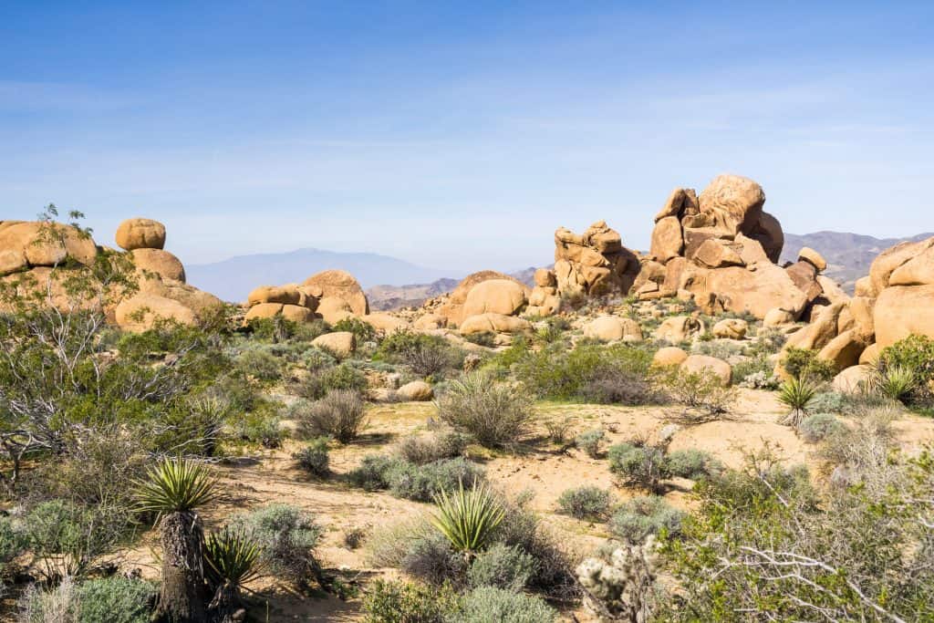
Distance: 1.8-mile loop
Average Time: 1 ½ hours
An easy trail for the new hiker and a fun one for the experienced, the Skull Rock Nature Trail takes you through a field of rocks and boulders, past the Jumbo Rocks Campground, and alongside the amphitheater. There are gentle ascents and descents and multiple offshoot trails if you want to spend a little longer exploring.
Know before you go:
- The trail is close to the road, and there is constant traffic noise.
- A popular spot, the trail’s a busy one.
- If you want to see Skull Rock without the hike, walk the trail in reverse, and you’ll be there in moments.
El Moro Canyon Loop Trail, Crystal Cove State Park
Distance: 5-mile loop
Average Time: 3 ½ hours
This pretty hike with a gentle slop rewards you with stunning ocean views with minimal effort. The small uphill section is enough to get your heart pumping but falls way short of strenuous.
Although dry and a little dusty, the trail is wide and easily followed. There are no uneven surfaces or loose ground to worry about. However, you might want to give it a miss in the summer as the trail can be scorching and dusty.
Know before you go:
- There’s a $15 fee per car in the parking lot.
- No dogs allowed.
- Has interpretive markers with QR codes.
Laurel Canyon Trail, Laguna Coast Wilderness Park
Distance: 3.8 miles round trip
Average Time: 2 hours
At its highest point, the Laurel Canyon Trail rewards you with beautiful views of the Santa Ana Mountains, while at its lowest, you get to crisscross the stream bed under the shady boughs of old oak trees. If you visit in the winter, after heavy rainfall, you might be lucky enough to catch the seasonal waterfall.
Posts along the trail have phone numbers. Call them up, and you can hear pre-recorded information about that section of the trail.
Know before you go:
- There’s a $3 parking fee.
- Very popular so it can get crowded.
- The park is open until sunset, but the parking lot closes at 5 pm.
Baldy Loop, Angeles National Forest
Distance: 10.3 miles
Average Time: 7 hours
Considered one of, if not the most challenging hike in Southern California, the Mount Baldy Loop comprises two trails – the Devil’s Backbone and the Baldy Bowl Ski Hut Trail. Most people take one trail up and the other down, and if you want to cut out some of the elevations, there’s a ski lift on the Devil’s Backbone to help you out.
During the winter, the trails can be snowy and icy, requiring crampons, ice axes, sturdy winter footwear, and suitable clothing to navigate them safely. Many people have died on Mount Baldy, so it’s important not to underestimate it.
Know before you go:
- It can become frigidly cold, so make sure you have plenty of layers, even in the summer.
- The topography causes micro weather systems, so sudden thunderstorms are not uncommon.
- A map is a must.
Hike Safely
So, there you have it, 13 of the best hikes in Southern California, with something for everyone, no matter what their age, physical ability, hiking experience, or interests.
However, one word of warning – never underestimate the potential danger of going for a hike. Always:
- Take the time to research a trail before you go and if the hike requires knowledge or skills you do not have, choose another spot.
- Check the weather before you go.
- Wear appropriate footwear and clothing.
- Don’t leave the trail to explore.
- Pack more water and snack than you think you need.
Related Content
To upgrade your backpacking experience check out our recommended backpacking gear. This is the gear that I use whenever I want to stay the night in the outdoors. Keep in mind, however, that these items are not necessarily all the highest-end items. My goal on this page is to recommend gear that is priced really well while still maintaining a high-quality standard. This is the stuff I use.
If you get bored during hikes and backpacking trips, you can add some entertainment by listening to music/podcasts, playing games on the trail, setting personal challenges, and collecting trailside items. Traveling by yourself can be boring, so find a friend or a group to go with you.
When you’re talking about an outdoor adventure in a forest or mountain, you might use the words hiking and trekking interchangeably. But after taking both hikes and treks, I can assure you that these two words refer to completely different outdoor activities!